Monday, October 23, 2023

Walk 20. Faversham to Whitstable

Today’s walk begins in Faversham, back at the bridge over the creek where I finished last time.


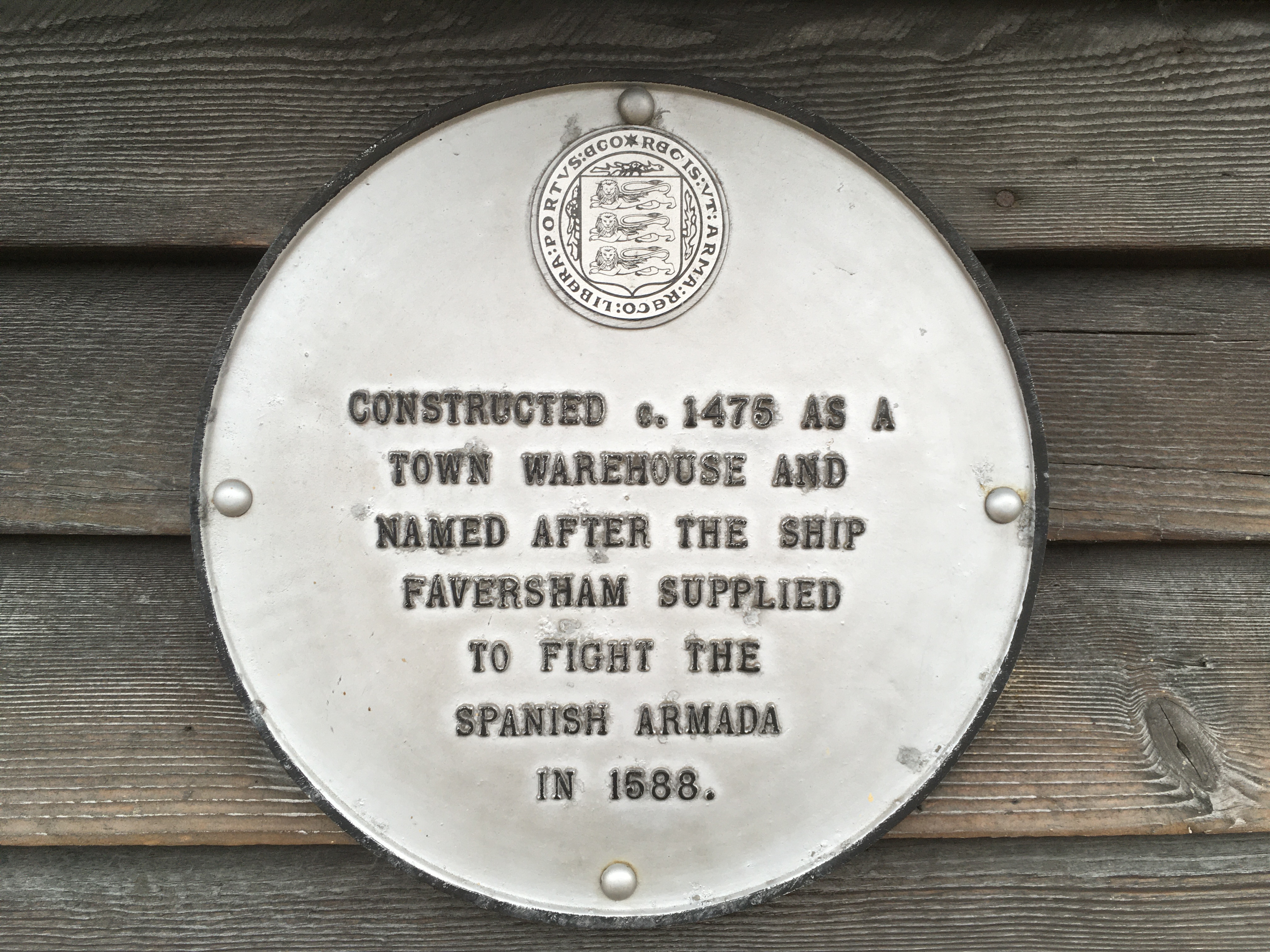
Faversham looks a great little town to visit. A medieval market town, today it has lots of interesting independent shops and cafes as well as some picturesque old buildings. Possibly the oldest is this one, complete with helpful plaque…


The other thing Faversham is famous for is the Shepherd Neame brewery. Founded in 1698 it is claimed to be the oldest brewery in England, so they’ve had plenty of practice! They run tours of the brewery for the public but you do need to be over 18 for some reason…

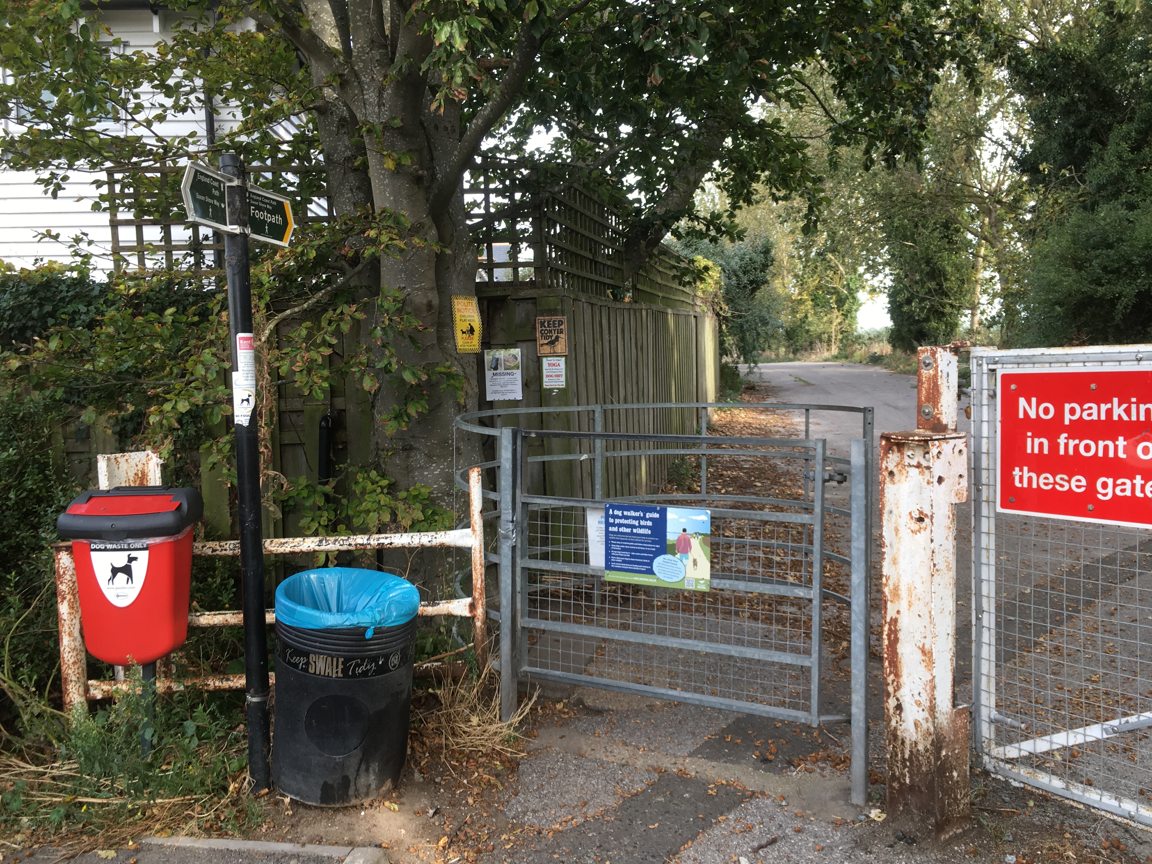
Anyhow, I don’t have time for a tour today so walk on by…


The first part of the walk today is along the east bank of Faversham Creek back up to the Swale. After passing an expensive-looking new riverside housing development I come across Standard Quay, home to yet more artisan-type businesses!


The path passes more fine old architecture…


…before entering a large boatyard…


To leave the boatyard on the other side you have to pass through a turnstile for some reason!


I’m now out of Faversham and back on a grassy embankment alongside the creek. It takes little time to reach Nagden, a tiny hamlet of a few houses and the last habitation I’m going to see for a while!

Out on the Nagden Marshes there is activity involving diggers and men in hi-vis. I pass a sign that tells me that they are building a solar power farm. Cool…


About twenty minutes later I reach the point where Oare Creek and Faversham Creek meet. Across the water is the Shipwright’s Arms pub that I passed on the last walk. I seem to have walked a long way just to be a couple of hundred yards away from where I was!


Another five minutes or so and I’m at the end of the creek and back on the bank of the Swale…


There now follows a stretch of several miles that takes me to Seasalter on the outskirts of Whitstable. At some point the Swale ends and the sea becomes Whitstable Bay, although I’m not sure exactly where that point is!

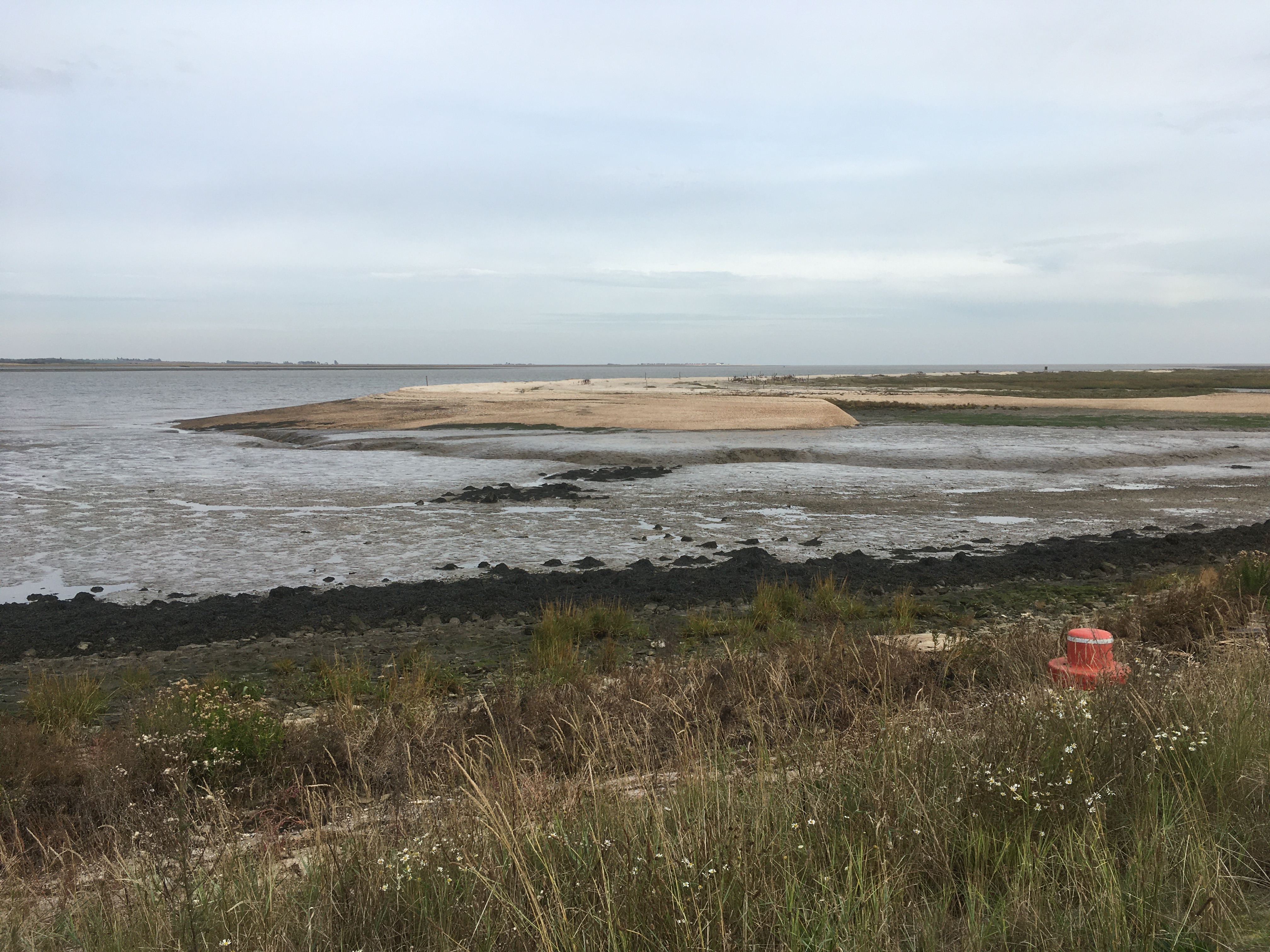
A short distance along the way I pass the Castle Coote nature reserve. After so much marsh and mud, this stands out quite dramatically thanks to the pale sand and shingle…


Unfortunately I’ve forgotten to bring food on this walk and I’m starting to feel peckish, so I’ll have to look out for a shop or a cafe. Might be a while though…


Half an hour later and there are signs of civilisation in the distance. Beach huts! To the left of this photo you can just make out a headland in the distance. This is Whitstable and the finish point for today…


About a mile further on I find a small cafe that looks shut but has an ‘open’ sign outside. I go and have a look and not only are they open but they provide an excellent bacon sandwich! 

Hunger assuaged, I continue into Seasalter. It’s not clear where the coast path goes here. I walk on the beach and a few yards on there is a prom but it doesn’t seem very friendly. The public right of way clearly passes along the prom but the owners obviously want to try and convince people otherwise…


And in the middle…


Makes you want to find a member of the Granville Cliff Estate Company Ltd and beat ‘em round the head with an OS map! Or is that just me?

Anyway, moving on…


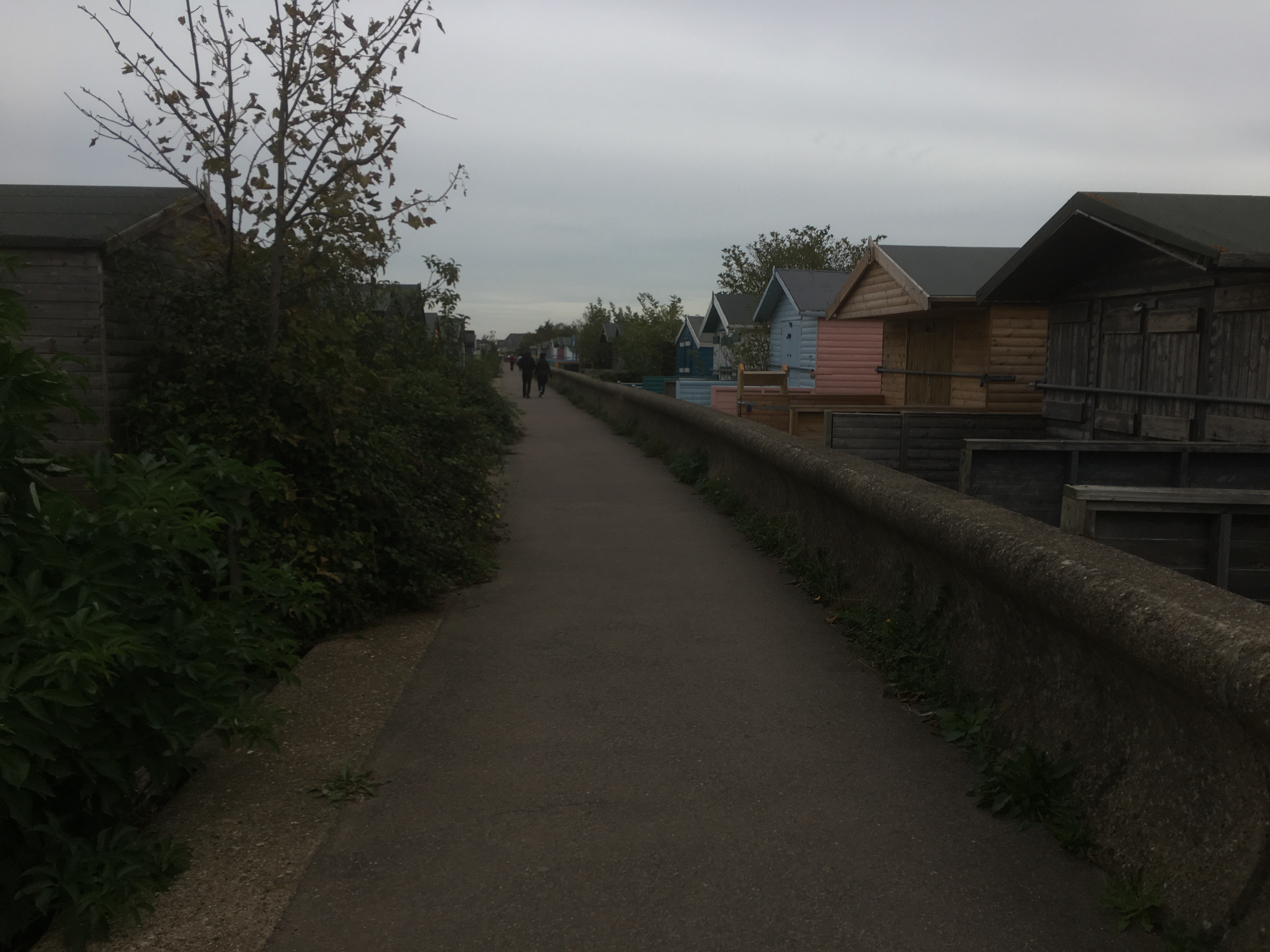
Passing from Seasalter into Whitstable there are loads of beach huts. Double stacked…!


Whitstable seafront has plenty of unusual and expensive beachfront properties…


…and, of course, plenty of evidence of what Whitstable is most famous for - oysters!


I arrive at the harbour where I am finishing for today…


It’s been a good walk, this one, with plenty of variety. Reaching Whitstable feels like from now on its ‘proper’ seaside, and the estuary landscape is finally done!


Wednesday, October 11, 2023

Walk 19. Conyer to Faversham

 I begin today’s walk back in Conyer and head up the eastern side of the creek on the road past the Ship Inn…


A couple of minutes later the road is gated off, but the public footpath continues up it past a barrage of signs!


Soon the buildings end and the creek comes back into view…


…and then I’m back on a grassy embankment…


Near the mouth of the creek are more mud-boats…


…and right at the mouth is an old wharf…


Presumably this was connected with the old industrial works that is marked on the map, but today seems completely hidden by bushes!

Turning the corner away from Conyer Creek and back out onto the south bank of the Swale, I pass Fowley Island. This is a long, thin, flat island in the Swale that resists my attempts to get a half decent photo…


Inland are several old concrete structures that I guess are the remains of a disused rifle range.


After this, I continue for half an hour or so. There is nothing here but the marsh - no people, no buildings, no ruins, nothing! But the weather is lovely and warm, and the path is easy to walk, so the time passes pleasantly quickly.

As I approach Oare Marshes there is more evidence of an industrial past. There are the remains of buildings, which I believe are the remains of old gunpowder works (very similar to the Hoo Peninsular), and a small silted up dock called Dan’s Dock. Who was Dan, I wonder?


Not far on I reach the southern side of the Harty ferry crossing. I encountered the northern side on the Isle of Sheppey but to recap this was a ferry across the Swale that ceased running back in the 1950s.


There is a small but busy car park here, with plenty of people out dog-walking and bird-watching.


I continue along the rest of the path to the creek. I’m unsure if this bit by the Swale is Faversham Creek or Oare Creek as the two meet further up. 


Although the other side doesn’t look very far away, this twin-creek complex is going to need quite a detour. I have to walk down the western bank of Oare Creek for a mile or so to the bridge in the village of Oare. Then I have to return up the eastern bank to the point where it meets the Faversham Creek, and then follow the western bank of the Faversham Creek in a big curve until I reach the bridge in Faversham. 

That will be the end point of my walk today, but next time I will have to start by walking the eastern bank of Faversham Creek back to the Swale!

Setting off down the creek I pass more mud-boats…


…before reaching the point where the two creeks split…


Passing down Oare Creek, pretty much the whole of the opposite bank was occupied by moored boats and boatyards.


It takes about twenty minutes to get to Oare village where I turn left over the bridge.


Now, if I wanted to cheat, the road ahead is less than a mile to the bridge over Faversham Creek, but I want to do the loop around the creeks. That’s about another four miles.

So I turn left after passing the white building in the photo above and head back along the other bank of Oare creek past all the boats!


Back where the Oare and Faversham Creeks meet is what looks like a very isolated pub called the Shipwright’s Arms, although there are several people enjoying a pint in the garden!


Past the pub the path goes through a gate into a field…


Noooo! 

If you’ve read my ‘Harty Ferry to Sheppey Crossing’ post you will know I’ve already come across a bull causing problems, so I’m slightly dismayed to see this sign! Anyway, nothing ventured and all that, so I bravely go through the gate!

I can’t see a bull, so that’s good. Just a herd of cows in the distance…


I briskly traverse the cow field and go through the gate on the other side. The rest of the walk beside the creek is more relaxed, although it does seem to go on for a long time because it does a fair bit of winding in and out.

At last Faversham is getting close, but as I approach the gate into the final field I spot another potential spanner in the works. On the gate is a big red notice saying ‘Footpath Closed’. I walk up to the gate and find it padlocked, and at the far end of the field is a digger with blokes in hi-vis dotted about.

This is a bit of a bugger. I don’t fancy retracing my steps for four miles so I decide to blag it. 

I climb nonchalantly over the gate and continue down the path. As I approach the work site, one of the guys tells me the path is closed. After explaining four miles, bull in field etc he kindly lets me continue as long as I don’t mind climbing over the gate to leave the field (obviously not - that’s how I got in!), and I leave the path to give the digger a wide berth. Health and safety you know. I tell him I’d rather take my chances with the digger than a bull and he says he sees my point!

Having safely left the field, I walk through the outskirts of Faversham towards the bridge over the creek. On the way I find an information board detailing the Two Creeks Circular Walk and is quite a good illustration of how much extra walking is needed to get round the creeks!


And here is the bridge at the end of today’s walk…