Today's walk is fairly short, only about four and a half miles.
I begin where the coast path leaves the Allhallows holiday camp and heads east towards the Isle of Grain.
This is what you want - a lovely sunny Autumn day and an easy grassy path beside the shore...
Things to see along the way include ships (as usual)...
...and swans in the marshes. Who knew the Thames Estuary was home to so many! Or maybe it's the same swans and they are following me?
About half an hour in, I reach the Yantlet Creek. This used to join the Medway Estuary at it's other end, making the Isle of Grain a true island. A causeway was built across the creek in the early 19th Century and the modern road still follows this route.
This is the view across the mouth of the creek where it flows into the Thames Estuary. The beach on the far side looks nice...!
The Yantlet Creek marshes with Essex in the distance...
About a mile up the creek is the only other way to reach the Isle of Grain without a boat! There is another causeway here for the use of farmers. Although walkers did use it, it was not an actual public right of way and was barred by a gate. To complicate matters, the whole of the Isle of Grain north of this crossing point is either private land or an enormous Ministry of Defence firing range. None of this area is accessible to the public, including that nice-looking beach!
I had prepared myself for a potentially dodgy ten minutes crossing the creek and reaching the road the other side, but as it turned out changes have been made...
Yes, this is now part of the England Coast Path and a public right of way across a very blue Yantlet Creek...
Once across the creek, don't follow the path. The firing ranges are just past those white houses...
Just to the right is a public footpath through this gate...
...which leads to a lane into Grain village.
The locals seem friendly enough...
Reaching the village, it is a short walk down to the beach.
From here, I want to head north along the beach to the boundary of the MOD danger area even though it means re-tracing my steps back to the village. It is only a fifteen minute stroll up the beach and, like Everest, it exits!
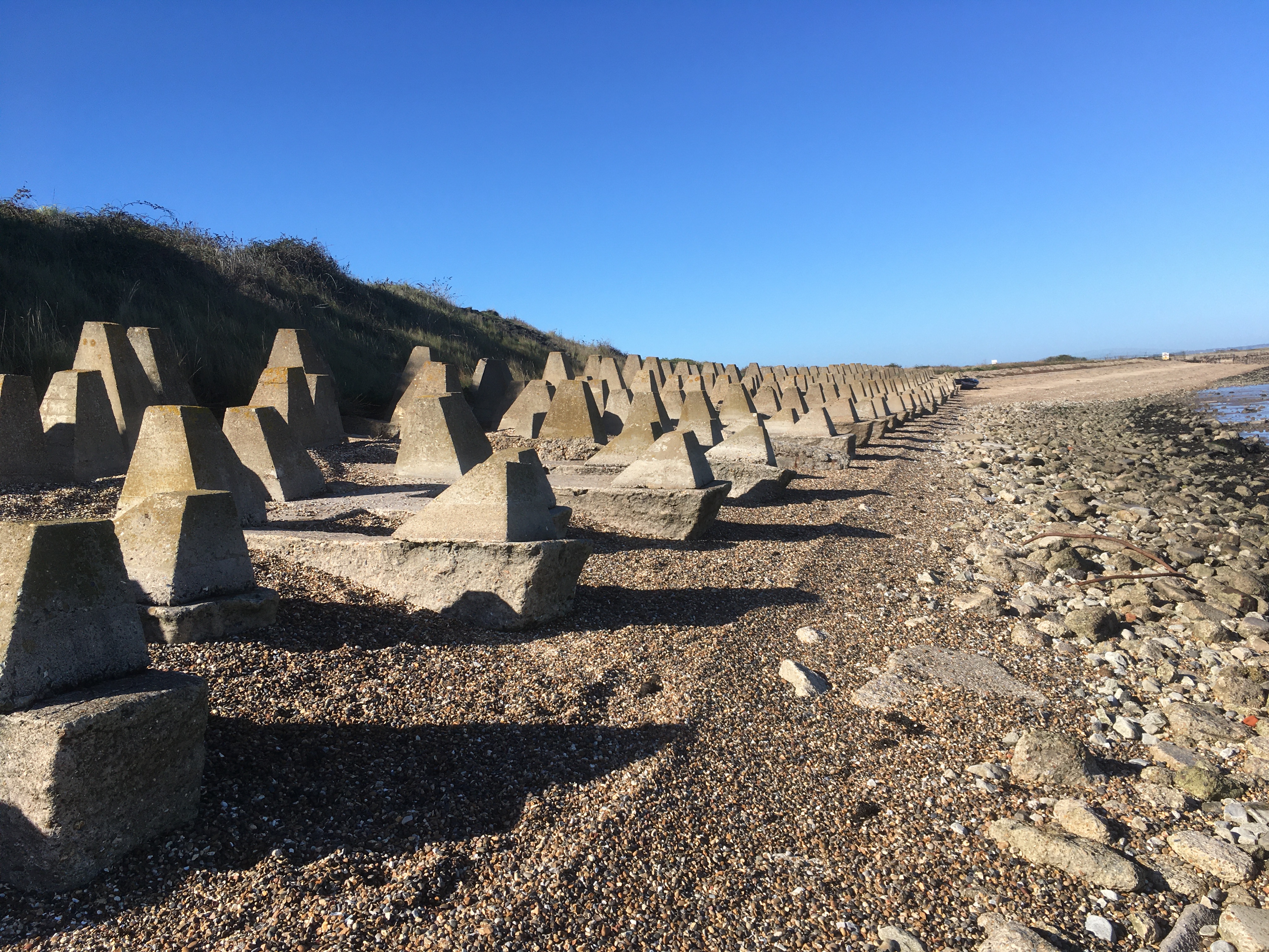
This is reputedly one of the few remaining places where you can see World War 2 'tank trap' beach defences in such well-preserved condition. They were designed to prevent tanks and other vehicles from crossing the beach during an invasion...
Seems they are also effective against mopeds...
The end of the line for today!
Although short, today's walk was very varied and interesting, helped by the perfect weather!
Next time I will finish the Isle of Grain and begin the Medway Estuary stretch.