Thursday, May 25, 2023

Walk 12. Lower Halstow to the Sheppey Crossing

 The walk today will be a bit like the last one because there are big chunks of coastline that have no public access.

The start point is the quay at Lower Halstow. This time the tide is out…


Next to the quay is the church of St Margaret of Antioch which dates back to Anglo-Saxon times, although much of the building seen today is 12th Century. 


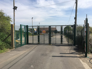
Past the church, the small Barksore Peninsula sticks out into the Medway Estuary. Unfortunately this is all private land and so I have to walk across the base of the peninsula along a road. Luckily I don’t meet much traffic as the road is quite narrow!


It takes about twenty minutes to reach the other side of the peninsula, and the road continues alongside the shoreline. The estuary here is called Bedlams Bottom on the map and is another expanse of mud and marsh. I can hear lots of birds but they are well hidden in the marshes! Shame about what looks like fly-tipped rubbish rather than flotsam washed up by the tide…


At one point the road is quite badly undermined. Some poor sod is going to be driving down here in the not too distant and end up down a hole!


Eventually the road-walking section nears its end. I walk up the low Raspberry Hill and find the path that heads out onto the Chetney Peninsula.


Although it looks impenetrable through there, the path does still exist and the bushes only go back a few feet then it opens out into a field of sheep.


At the bottom of the hill the path follows the western edge of the Chetney Peninsula as far as Chetney Hill which is about a third of the way up. The top two-thirds are, again, private property with no public access. So the footpath then cuts right across the peninsula to the eastern edge and turns back down the other side.

Soon after starting this bit I came across several rotting barges in the mud. It seems if you’ve got an old boat to dump, the Medway Estuary is the place to do it!


The path runs along the top of a raised bank with water/mud on one side and marshy fields and drainage ditches on the other. A lot of it is easy going but there are several stretches covered in leafy plants with some thistles thrown in. Fortunately, at the bottom of the bank, all the way round, is a nice ‘tractor track’ so I give up on the footpath and use that instead!


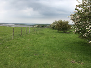

The Chetney Peninsula is a nice walk, but a bit featureless! There is plenty of bird life, but my bird recognition skills are rubbish so I only know I saw geese. Plus some other stuff. There were no other humans to be seen though.


As the path left the peninsula and headed along the bank of the Swale towards the Sheppey Crossing it became less overgrown and easier to walk on. There was even the odd dog walker.


My end point for today’s walk is the Sheppey Crossing. This is the newer of the two bridges here which link the Isle of Sheppey to the mainland. It is certainly an impressive structure as it looks so high! Walking underneath reminded me of going under the Dartford Crossing back on my first walk. Alongside it is the Kingsferry Bridge which carries a road, a railway, and most importantly from my point of view, a footpath! So that is where I’m heading next - round the Isle of Sheppey…


Tuesday, May 9, 2023

Walk 11. Rainham to Lower Halstow

 Today’s walk is fairly short and doesn’t actually have a massive amount of shoreline as there is no public access for much of it!

I start at the western foot of the Motney Hill peninsular…


Almost immediately I find yet another rotting old boat sat in the mud…


There are some nice views of Horrid Hill that I passed on the last walk…


I soon reach the point where the path heads inland. The northern half of the peninsular is home to a sewage works and is fenced off. Although it comes to a dead end, I turned left onto the beach just to see how far it went but the aroma wafting over persuaded me to turn back after a couple of hundred yards!


The path follows the road up to the sewage works then turns right and heads back to the shore on the eastern side of the peninsular.


After a short bit of zig-zaggy shoreline…


…it was back inland for quite a way. Most of the coastline of the Upchurch peninsular seems to be private land with no public right of way. As a result you have to cut diagonally across it to meet the shore half way down the other side.

There is a fair bit of road walking involved…


…and several fields of, I think, hops. Growing beer! Lovely!


I would like to thank Julia for putting a welcoming sign on her gateway, it’s much appreciated!


After an hour or so I’m back at the coast near Ham Green. The coastal path from here all the rest of the way to Lower Halstow is well-made and mostly runs on top of grassy banks alongside the estuary mud.


About half way along this section I pass Twinney Wharf which seemed eerily deserted…


On reaching Lower Halstow I find more boats, including this big old barge…


Apparently it is one of two boats run by Tiller And Wheel who offer boats trips to the public!


So that is today’s walk done. I’ve just realised that there were no old pill boxes on this walk! That’s a first! Maybe nobody thought the Upchurch area was worth defending…