Thursday, March 14, 2024

Walk 25. Sandwich to Deal

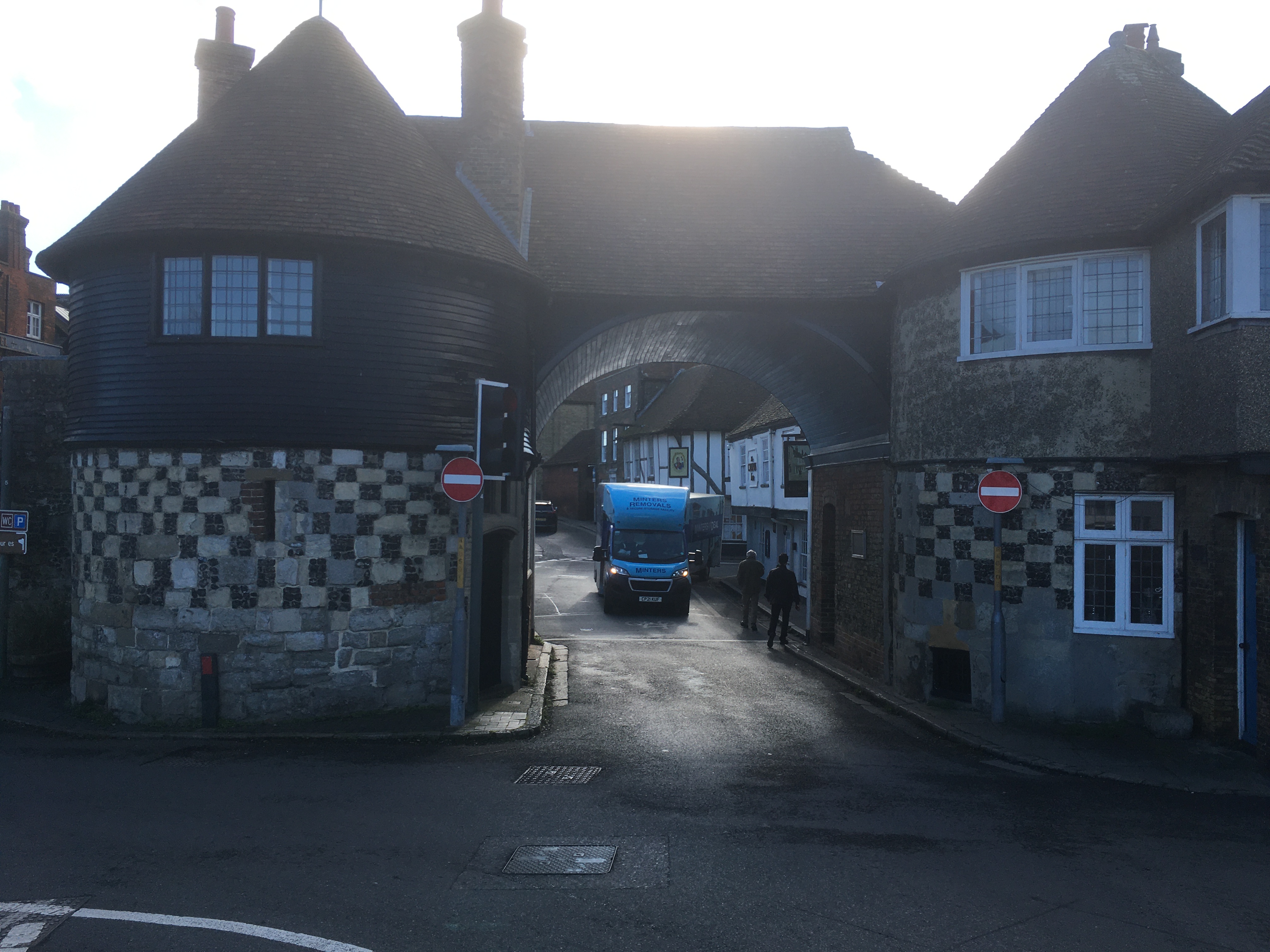
 So here I am, back at the bridge in Sandwich for the next leg.


The US Navy patrol boat I mentioned at the end of the last post has an information board, although why it ended up in Sandwich is a mystery…


A few yards up the bank is a small wooden building…


It turns out this is the workshop of the Sandwich Medieval Trust, which looks an interesting organisation!


Heading out of Sandwich I cross this small bridge which takes me onto the marshes. 


This first section of today’s walk follows the east bank of the Stour to the sea. This does mean I have to head back north before I can continue south! Never mind, the path is good…


Over on the opposite bank I can see all the industry that the long road walk skirted past last time.


Soon the path becomes a grassy bank, still easy to walk on but interrupted by several gates where it crosses farm tracks. It’s also bloody windy out here!


There are also comforting signs such as this…


Eventually I near the sea. ‘Hooray!’ I think, but the path turns past some trees, and because it’s no longer on an embankment, becomes a bit damper…


Luckily my boots are good and my feet stay dry, and I arrive at the beach. I’m surprised to find that I have already covered four miles zigzagging around the marsh! It didn’t look that far on the map! The northernmost point is a nature reserve and cannot be accessed, so from here it is a straight line to Deal which sounds easier.


The beach here is lovely, nice firm sand to walk on backed by dune-type grassy bits. No actual dunes though, it’s all quite flat! Deal can be seen in the distance and doesn’t look too far away. This half of the walk should be a doddle! It’s still very windy, though. And now it’s blowing directly into my face!


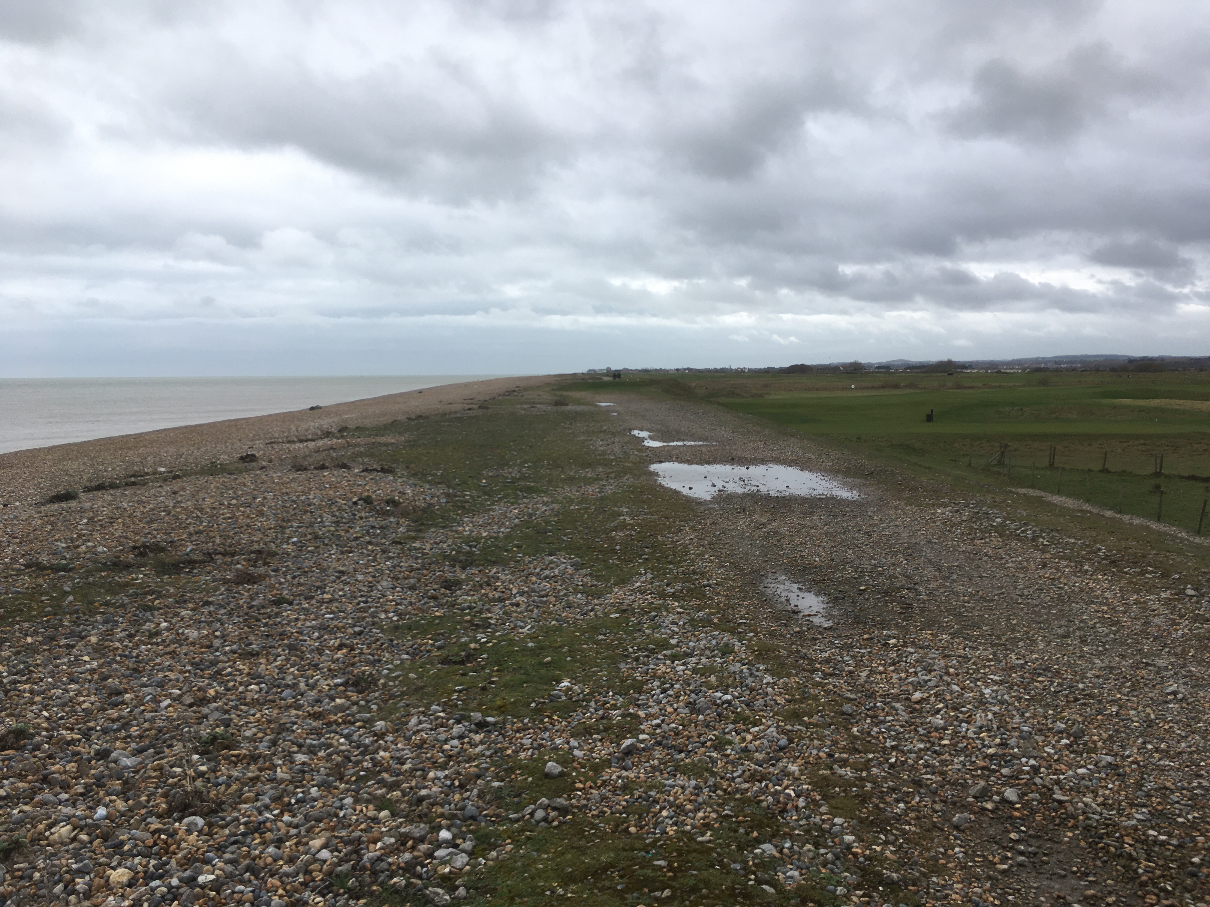
On the landward side of the beach is a golf course. It is actually the first of three that seem to occupy most of the coast between here and Deal. 

I make good progress along the sand, although there are some pebbly patches that are slower going and walking into the wind is getting a bit tiring. It takes the best part of an hour to reach the private Sandwich Bay Estate. Apparently non-residents can drive here but have to pay a toll. There is a car park with three or four cars in it, the occupants all seem to be on the beach fishing.


I am now walking along the path behind the beach as the sand has disappeared and it has become steep pebble banks. The path is also covered in pebbles and is heavy going. And seems to go on, and on, and on, featureless into the distance! Oh, and did I mention the wind? So much for my easy walk along the beach - I’m bloody knackered!


At last I reach the outskirts of Deal…


This northern end of the town is marked by the site of Sandown Castle. There is an ornamental garden and an information board. Which is nice.


From here it is only a short walk along a nice, flat prom to the pier where I am finishing today!


Right. That’s it for today. I’m off for a sit down and a coffee…!

Tuesday, March 12, 2024

Walk 24. Broadstairs to Sandwich

 What’s this? Sunshine? Blue skies?

It’s actually NOT raining today! So I’m taking advantage of the weather and doing the next leg of the Kent Coast.

The start today is Broadstairs, although the bay is called Viking Bay.


From up here there is a much better view of Dicken’s Bleak House than I was able to get last time…


I head south along the sea wall through the tiny Louisa Bay, along South Cliff, and past the interestingly-named Dumpton Point.


In Dumpton Bay the sea wall ends and I continue along the sand. This is another section that cannot be accessed at high tide as the water reaches the cliff face. 


It looks like those warning signs are needed as a couple of minutes later I pass a rockfall that looks quite recent!


Approaching Ramsgate the sea wall reappears, and I walk along it into the town passing the entrance to Ramsgate Tunnels. Today this is a visitor attraction, but originally these tunnels were used during WW2 as air raid shelters for the civilian population.


Shortly after, I reach Ramsgate harbour. This is still a working harbour with a lot of industrial-looking areas together with interesting old buildings and touristy-type businesses. Quite a mix! Here is a selection of sights…


The road continues along the bottom of the cliff towards the Pegwell Tunnel where it heads inland.


The pedestrian path continues to the left for a short distance then the sea wall ends and there is a nicely landscaped way up to the cliff top at Pegwell.


From the top, there is a great view out over Pegwell Bay…


The road through Pegwell has a nice selection of picturesque buildings…


…and then the path turns left down a lane, past a few houses, and then becomes a bit overgrown as it follows the cliff top down into the bay.


The path gently descends into Pegwell Bay and flattens out at this large expanse of disused concrete that is slowly being reclaimed by nature…


This is the remains of the hoverport used by the cross-channel hovercraft. Increasing costs forced the service to close in the early 1980s, but in their heyday these giant beasts carried millions of passengers and their cars across the channel in a fraction of the time that it took a traditional ferry. Today, if you want to travel by hovercraft, you will have to head for Portsmouth where the ONLY regular passenger-carrying hovercraft service in the WORLD will take you to the Isle of Wight.

Hovercraft are cool.

Hidden in the bushes at the back of the concrete apron is a set of steps that takes me up to the road through Cliffs End. Here I find a magnificent replica of a Viking ship! This is pretty cool too…


About five minutes up the road from the Viking ship is Pegwell Bay Country Park. This is a marshland wildlife habitat with some well-maintained paths, and seems to be popular with dog walkers!


The park doesn’t  take long to walk through, which is unfortunate because the rest of the walk to Sandwich is along a very straight, very boring road that looks like this…


After fifty minutes I finally arrive in Sandwich at the small bridge over the River Stour. After the monotony of the road section, Sandwich offers some interesting stuff to end the walk with. A strange little bridge…


Some boats, including a Cold War era US Navy patrol boat…


And what looks like it might have once been a medieval gatehouse to the town…


So that wraps it up for today’s walk, which can be summed up, I think, by the word ‘variety’!