Monday, May 26, 2025

Walk 45. Pagham to Selsey

 I start today’s walk on the pebble beach outside Pagham Yacht Club…


Most of the route today will be around Pagham Harbour, a large nature reserve on the site of a medieval harbour that silted up and became disused. The area is protected from the sea by large shingle banks on either side of a narrow tidal channel.

So my first task is to get to the end of the pebbles on this side. I follow the back of the beach, past a confusing mess of shingle banks and tidal lagoons…


After fifteen minutes I’m approaching the end of the spit…


And here is the view across the channel to the southern spit…


From here I have to retrace my steps for a few hundred yards back to the footpath that heads off around the harbour…


This is the view across Pagham Harbour nature reserve - it’s quite big…!


The first part of the path is a nice easy walk through some foliage…


It then cuts across the edge of the marsh where, amazingly for me, I actually spot some wildlife in a nature reserve!


Shortly I arrive at the North Wall where there is a handy information board.


Along here I spot more wildlife - must be a personal record…!


At the end of the North Wall I have a choice. One path cuts inland to Sidlesham Quay, while the other runs along the edge of the marshes to the same place. Apparently the marsh route is difficult to impassable at high tide or if the weather has been very wet. Today it seems dry enough, so I go that way…


This takes me to the lovely-looking little village of Sidlesham Quay…


In the village I find an info board about a Victorian tramway. It seems that this section of path round the harbour follows the old tramway route along an embankment.


After a while the tramway heads inland, and the harbour path drops back onto the edge of the marshes. For  a short section there is even this nice wooden walkway…


Eventually I arrive back at the beach…


I turn to my left, the north-east, to walk the short way to the entrance of Pagham Harbour…


Ten minutes later I’m looking back across the channel between the shingle spits. Just over there is where I was standing two-and-a-quarter hours ago. Could they not just build a bloody bridge…!


I plod back down the shingle in the direction of Selsey. It doesn’t look far on the map but the pebbles seem to go on for ages. At last, houses appear with a decent path running past them…


At the start of Selsey prom there is a blue plaque…


Well, who knew?

Now it is just a short walk along the prom…


…to Selsey lifeboat station where I am finishing for today!


Thursday, May 15, 2025

Walk 44. Bognor Regis to Pagham

 Today I’m squeezing in a short walk from Bognor to Pagham.

I start back at Bognor pier and set off along the esplanade…


After a mile or so, the esplanade ends and I move onto the beach. Mmmmm…pebbles, my favourite!


I reach a groyne made from boulders. The tide is coming in so it is almost inaccessible, but I am just in time to cross it via these steps…


On the other side the pebbles continue…


I’m now on Aldwick beach and plod on past some very expensive looking houses that back onto the beach…


Someone has built a mini pyramid from the white stones on the beach. Must have taken a while…


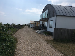
As I approach Pagham the beachside properties become less palatial…


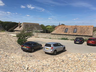
And then I find myself at today’s finish point, Pagham Yacht Club…


Well, I did say it was a short one!


Sunday, May 11, 2025

Walk 43. Littlehampton to Bognor Regis

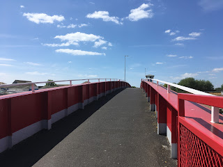
 I begin my walk today by crossing the footbridge over the River Arun…


On the other side I follow the river bank back to the sea, first down a small road…


…then along a path passing various boatyards and the like…


After about three-quarters of a mile I reach the point where the river flows into the sea…


There is a car park and cafe here but the beach is remarkably deserted apart from a few dog-walkers. It’s quite warm today but maybe the breeze is putting people off! 


The tide is out, exposing plenty of sand which is much easier to walk on than the pebbles at the top of the beach! Behind the beach are a lot of dunes that are fenced off to protect nesting birds and other wildlife. The beach seems to go on for miles…


It turns out the beach does go on for miles! There is the tiny settlement of Atherington about halfway where there are some loos and a cafe…


…but not much else until I get to Middleton-on-Sea. Middleton has some interesting sea defences in the form of piles of large stone blocks. Instead of being placed at the top of the beach, or built out at right-angles like groynes, they are out at the low tide mark…


It is also around here that a long row of houses have their back garden walls built right up to the beach. It looks like the sea reaches them at high tide and the Coast Path is diverted inland to by-pass them. If you are thinking of walking this section, once again - very important to check your tide times, kids!

By the time Middleton merges into Felpham the footpath reappears beside the beach…


Soon the path becomes a prom, which continues all the way to Bognor.


Bognor seafront seems neat and pleasant but unremarkable. Except, of course, for the thing that Bognor is probably most famous for…yes, you guessed, a whacking great Butlins Holiday Centre!


Shortly after, I arrive at the rather sad remains of Bognor pier. Like many Victorian pleasure piers, this one  suffered late 20th Century decline including that popular pier pastime of bursting into flames! Still, at least a bit of it is still left…


This is my end point for today, so I’ll see you next time…!