Thursday, October 20, 2022

Walk 6. Allhallows to Grain

Today's walk is fairly short, only about four and a half miles.

I begin where the coast path leaves the Allhallows holiday camp and heads east towards the Isle of Grain.


This is what you want - a lovely sunny Autumn day and an easy grassy path beside the shore...


Things to see along the way include ships (as usual)...


...and swans in the marshes. Who knew the Thames Estuary was home to so many! Or maybe it's the same swans and they are following me?


About half an hour in, I reach the Yantlet Creek. This used to join the Medway Estuary at it's other end, making the Isle of Grain a true island. A causeway was built across the creek in the early 19th Century and the modern road still follows this route. 

This is the view across the mouth of the creek where it flows into the Thames Estuary. The beach on the far side looks nice...!


The Yantlet Creek marshes with Essex in the distance...


About a mile up the creek is the only other way to reach the Isle of Grain without a boat! There is another causeway here for the use of farmers. Although walkers did use it, it was not an actual public right of way and was barred by a gate. To complicate matters, the whole of the Isle of Grain north of this crossing point is either private land or an enormous Ministry of Defence firing range. None of this area is accessible to the public, including that nice-looking beach! 

I had prepared myself for a potentially dodgy ten minutes crossing the creek and reaching the road the other side, but as it turned out changes have been made...


Yes, this is now part of the England Coast Path and a public right of way across a very blue Yantlet Creek...


Once across the creek, don't follow the path. The firing ranges are just past those white houses...


Just to the right is a public footpath through this gate...


...which leads to a lane into Grain village.


The locals seem friendly enough...


Reaching the village, it is a short walk down to the beach.


From here, I want to head north along the beach to the boundary of the MOD danger area even though it means re-tracing my steps back to the village. It is only a fifteen minute stroll up the beach and, like Everest, it exits!

This is reputedly one of the few remaining places where you can see World War 2 'tank trap' beach defences in such well-preserved condition. They were designed to prevent tanks and other vehicles from crossing the beach during an invasion...


Seems they are also effective against mopeds...


The end of the line for today!


Although short, today's walk was very varied and interesting, helped by the perfect weather!


Next time I will finish the Isle of Grain and begin the Medway Estuary stretch.


Monday, October 10, 2022

Walk 5. Salt Fleet Flats to Allhallows

 I begin today's walk at the new wildlife reserve at Salt Fleet Flats, where I finished last time. 

Next door is Egypt Bay. It is a mystery where the name comes from. There are various theories about a supposed find of Byzantine coins in the dim and distant, but it sounds like a load of old cobblers to me. Not least because the Byzantine Empire didn't include Egypt!


The bay is very small but it does have a beach...


After skirting Egypt Bay it is an easy stroll to St Mary's Bay. The coast is pretty straight and the path is well maintained, with new-looking gates...


To the landward side is a small river, or creek, or maybe a fleet (?) which runs parallel to the path all the way from Egypt Bay, past St Mary's Bay and St Mary's marshes...


Some wildlife on the bank of the river/creek/fleet...


St Mary's Bay is a little larger than Egypt Bay...


...with a bigger beach!


Past St Mary's Bay I could hear a right old racket in the distance. Ten minutes later and I came upon the herd of cows that were making it as they were rounded up!


About twenty minutes later I reached Coombe Bay. This is not named on the OS map so I had to conduct extensive research to discover it's name...


Coombe Bay from the western side looking south-eastish...


From Coombe Bay the route passes the Dagnam Saltings and then on to the Allhallows caraven park. The path is well signposted and shows more evidence of recent improvement work...


This is good because the Dagnam Saltings look pretty much impassable, unless you enjoy wading...


Once past the saltings I reach the Allhallows holiday park. The path takes me through what in the olden days would be called a holiday camp, and is an easy walk across the grass with a traditional bit of sand-and-shingle beach to my left. This is my end point for today.


Looking back from today's finish...


A walk of two halves this one. The first half was utterly deserted, again! After St Mary's Bay it felt like I was slowly re-approaching civilisation - a couple of people herding cows, a couple of other walkers, then finally the holiday camp and boats and bars and stuff!


Next time - Allhallows to Grain. Apparently there are some access issues along the way! Should be fun...


Tuesday, September 20, 2022

Walk 4. Cliffe Pools to Salt Fleet Flats

 Walk 4 takes me out on the north coast of the Hoo Peninsula. The word 'hoo' is derived from an old Anglo-Saxon word for a projecting area of land, a bit like the word 'peninsula'. Which would make this the Peninsula Peninsula! Anyway, moving on...

I begin at the crossing point of Cliffe Creek where I finished last time.


A short ten minute walk brings me to the end of Cliffe Creek and back at the Thames Estuary.


I turn right and continue along the estuary. The path is nice and flat although I cant see much over the wall. This doesn't change for quite a way!


Lots of this, with the cranes of the London Gateway Port over in Essex visible in the distance...


...and the ever-present sheep to the right.


After a while I spot something different. A small stone obelisk is sitting beside the sea wall apparently trying to do an impression of the Leaning Tower of Pisa! The inscription is faded and hard to make out but this marks Lower Hope Point, the limit of the Port of London Authority.


Shortly after Lower Hope Point I pass the derelict buildings of an old explosives factory. They are well spread out in order to minimise the effects of any accidents. I'm sure that set the workers minds at rest...


I'm now getting closer to the London Gateway Port across the river...


Somewhere around here lies the northernmost point of Kent. It's a bit hard to tell the exact spot because the coast curves very gently and all looks the same. In fact, this sea wall and scrubby bush combo goes on for the rest of today's walk! I'm going to say its here...


Almost another hour of this view brought me to the end point of today's walk, the Salt Fleet Flats. This wildlife sanctuary was created in 2016 to replace habitat lost as a result of the London Gateway development. Lying just to the west of Egypt Bay, it isn't on the Ordnance Survey maps yet!


Talking of OS maps, this walk has a little post script. My plan was to return to my car, parked in Cliffe village, along a public footpath on the map, which ran pretty much from where I was directly across the marshes to the village. However, apart from one faded 'public footpath' sign near my starting point, there were no signs at all. There was not even a visible path on the ground.

As a result, what I had expected to be a forty-odd minute stroll turned into a two hour-plus slog - bumbling about in one field of sheep after another, trying to find a way through the barbed wire fences and drainage ditches. There were plenty of big red signs of the 'keep out, private property, trespassers will be shot' variety, at which I kept thinking "well if you didn't remove the footpath signs and block the path I wouldn't be lost and walking across your property!" So a slightly irritating end to the day!


Anyway. Next time - more Hoo Peninsula! Hopefully with fewer access issues...

Monday, August 8, 2022

Walk 3. Gravesend to Cliffe Pools

 Walk 3 begins in Gravesend where it is the law, apparently, that you begin with Pocahontas. Now you may be wondering what Disney princesses have to do with a slightly down-at-heel town on the Thames. Well, it turns out that the real life Pocahontas died in Gravesend in 1617 and is buried in St Georges churchyard in the town. So my first port-of-call was to see her statue...


From the graveyard I cross a small carpark to the road along the Thames. You can't actually see the river due to the blocks of riverside flats, though. Gravesend Pier is here as well. Built in 1834, it is the oldest remaining cast iron pier in the world and you can catch a ferry to Essex, should you wish to do such a thing...


The Pier is also the beginning of the Saxon Shore Way, a long distance footpath that follows the route of the coast as it was in Anglo-Saxon times. I can follow large sections of this path, but not all of it as the coastline has moved quite a bit over the intervening 1200-odd years!

Past the Pier, Gravesend has a really nice little waterfront area that packs a lot into a short walk. First up is an old lightship (bit like a lighthouse - but on a ship!) that is now an 'art space' (not sure - go and have a look if it sounds like your kind of thing!)...


Beside the ship is a statue commemorating "those from around the world who served alongside Britain in all conflicts 1914 - 2014" that features this imposing-looking dude...


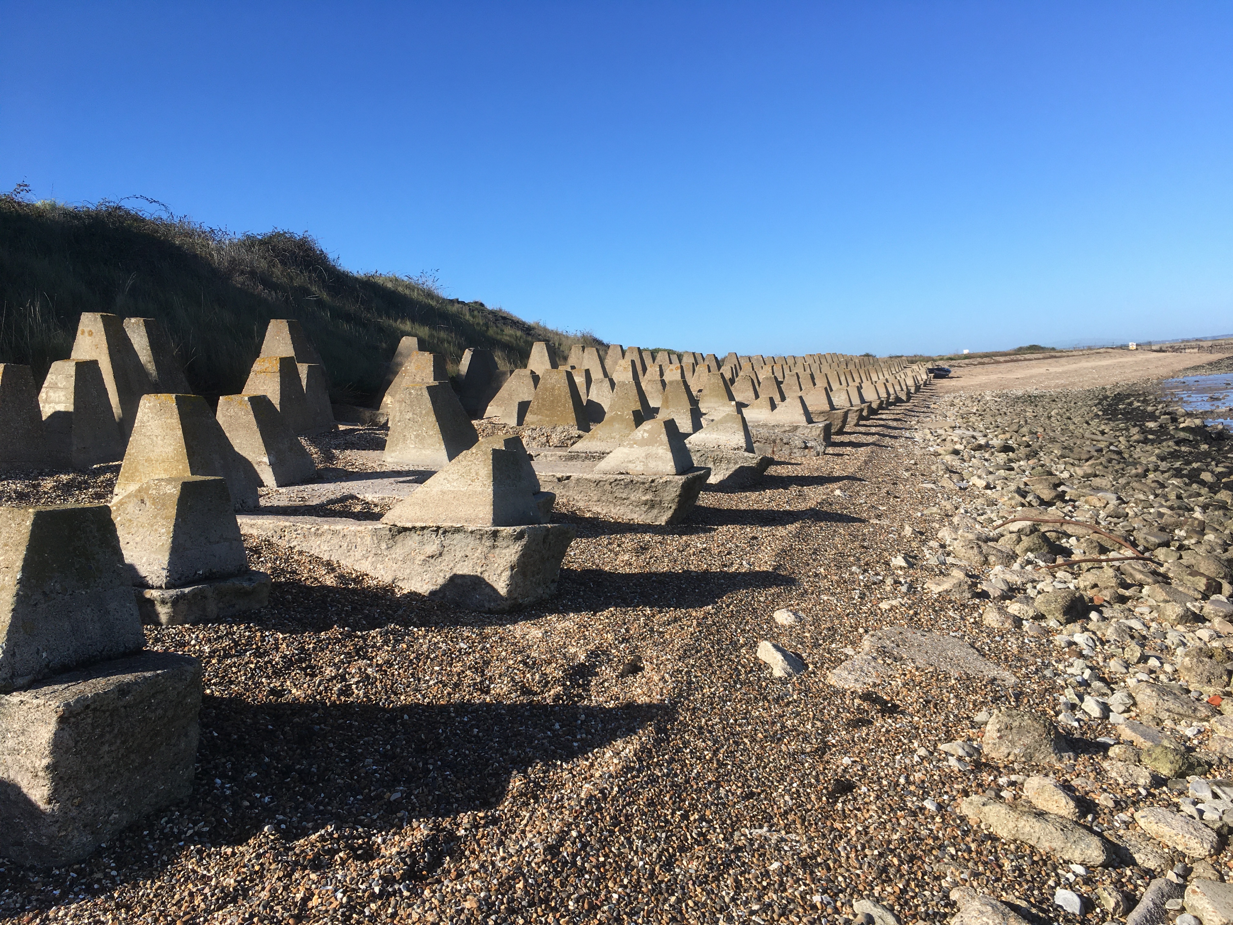
A bit further along is the site of a Blockhouse built by Henry VIII to defend the river. When I was there a couple of guys were doing a bit of preservation work on the remains.


Past the Port Of London Authority building there is a nice esplanade with benches, cafe, etc, although I can't guarantee these guys will be there...


So it turns out that Gravesend is well worth a little visit!

Next though is another industrial area. Half an hour later I am leaving the town and back out onto the marshes. To the landward side is a large area of firing range with plenty of 'danger area' signs and big red flags...


The next couple of miles are a lovely walk, nice even, grassy path, views over the Thames, peaceful and quiet.

Another half hour later, and I come to Shornmead Fort. This was built in the 1860s to defend the Thames and is now derelict and covered in graffiti. Still fun to have a bit of an explore and scramble over the ruins though!


Past the fort and it's onward across the marshes. Much of the rest of the walk is RSPB bird reserve. This bit is called Higham Marsh.

I'm now approaching Cliffe Pools. These have been developed on the site of old clay and gravel quarries to provide a variety of wildlife habitats. There is still some sort of gravel works operating here and behind the fence can be seen the remains of Cliffe Fort. Similar to Shornmead, this is yet another 1860s defensive structure but seems to be more intact. Maybe this is because it is closed to the public!


On the path round the fort is the remains of the launch-way of the Brennan Torpedo. This was an early experimental guided missile invented by the Australian Louis Brennan in the 1870s! I feel this should be more widely known about - the Victorians had a guided missile! Who'd have thought...


On the other side of the fort the path goes through the gravel works, including an exciting bit underneath a big conveyor thing...


...out the other end and I am at Cliffe Creek.


A short walk down the bank is a crossing point and the end of today's walk. All I've got to do now is find my way back to the car!

Mileage on this walk was about six and a half. Gravesend has a cool little riverside area and once you are out on the marshes it is so quiet. I think I only saw three other people out there and one of them was working at the quarry!

Next time - more Hoo Peninsula, more marshes...