The start of today’s walk is Herne Bay pier and the view ahead is of a sand and shingle beach backed by the prom. I love having a prom to walk down!
…and a bench in the shape of a biplane…
…and another information board about the bench…!
Of course, there is also a statue…
I must admit that, other than the record-breaking flight to Australia, I don’t know a lot about her. I certainly didn’t know that she crashed somewhere off Herne Bay. She seems to have lived such an amazing life you would think someone would have made a big feature film about her!
Just a couple of minutes further on from the statue is the other thing that Herne Bay is proud of - the iconic Clock Tower…
The seafront is a very pleasant walk. There are well-kept ornamental gardens and plenty of cafes and pubs, so I would recommend a visit!
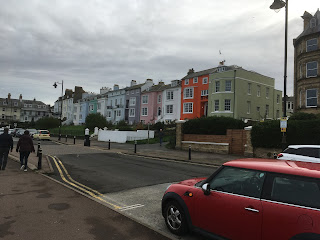
Balamory has a lot to answer for…
The wide concrete prom continues out of Herne Bay until I reach Bishopstone Cliffs. From here you can either walk on the beach or along the cliff top. If you take the beach option you need to be aware of the tide as this is another section where the sea can reach the cliff face and cut you off!
I take the cliff top option and climb the steps. Fortunately the cliffs are not high!
From the top are some nice views back to Herne Bay with the Isle of Sheppey visible in the distance…
Ahead is Reculver Country Park which slopes down to Reculver and it’s famous towers…
Reculver is a tiny place with a pub, a cafe, a car park, and some mobile homes. It’s best known for the Reculver Towers which are the ruined remains of a medieval church and can be seen for miles! The church itself was built in the middle of an earlier Roman fort that was one of the so-called Saxon Shore forts.
The Saxon Shore was a defensive network of forts along the coast of south-east Britain which were designed to protect the province against raiders from across the North Sea. A similar problem was to occur several centuries later, of course, but this time the attackers were called Vikings!
Due to coastal erosion only the remains of the southern half of the fort still exist - the other half has been eaten by the sea!
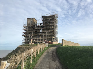
When I arrive I find the church ruins are fenced off and covered in scaffolding as some preservation work is under way.
There is not a lot left to see of the Roman walls…
The next section is a three mile walk along the sea wall to Minnis Bay. Back in Roman times the Isle of Thanet was an actual island separated from the mainland by the Wantsum Channel. As the information board shows, it was quite big…
This is the view ahead, with a shellfish farm just in front and Minnis Bay in the distance…
This is a great walk along the wide sea wall. Along the way I’m passed by several cyclists so it’s clearly a favourite local bike path. There are also two saline lagoons that are home to rare wildlife, although all I see are a couple of swans. Which are not rare…
From here I round the small headland into Grenham Bay. The bay is very small but has this unusual arrangement of sea wall that is sort of ‘built-in’ to the low chalk cliffs!
This brings me to the finish point for today, at this slightly anonymous path…


No comments:
Post a Comment